|
Digital Typhoon: Heavy Rains in Tohoku Region (September 2015) - Case Studies of Heavy Rains |
|
|
1. Heavy Rains in Tohoku Region (September 2015)
This page summarizes weather data related to heavy rains in Tohoku Region on September, 2015, caused by Typhoon 201518. Data for the same period is also available at Heavy Rains in Kanto Region (September 2015).
Radar Imagery
Real-time weather radar images are cropped for the region of heavy rains, and make them available as time-series images.
- Radar Imagery (Zoom 8)
- MP4 Animation
- GIF Animation
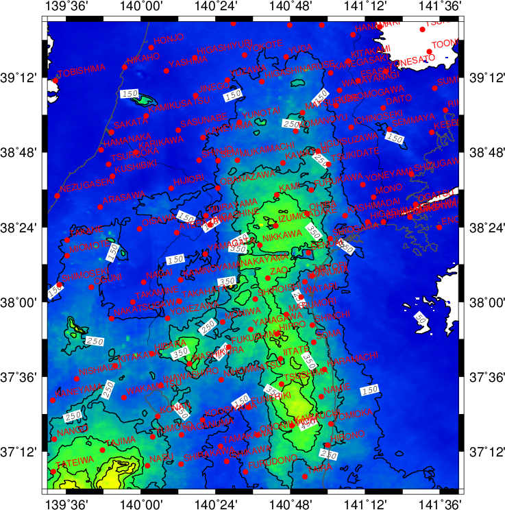
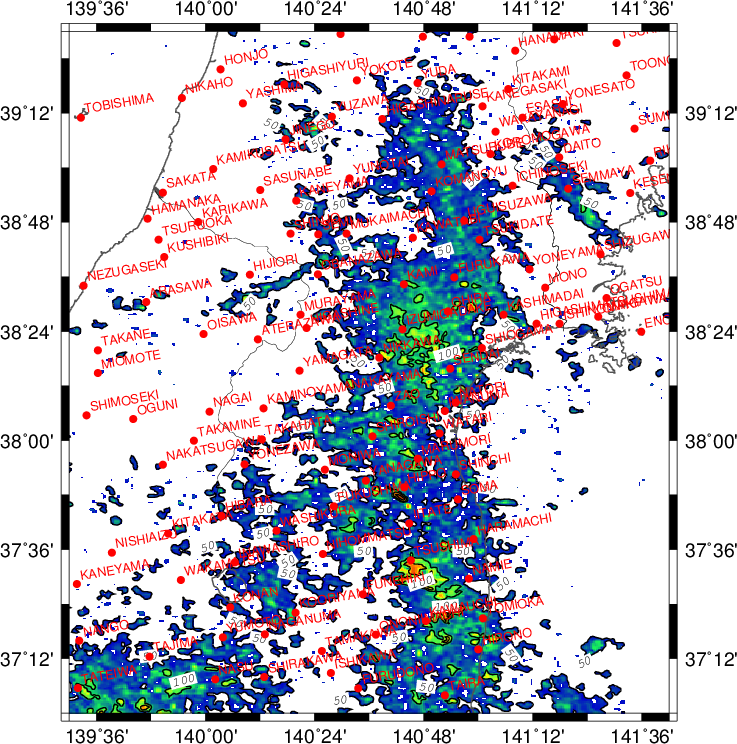
The images below illustrates the spatial distribution of radar observations from JST 00, September 9, 2015. These observation values, however, were not calibrated by ground-based observations, so it may not be accurate as the absolute value. It should be used as relative values illustrating spatial distribution.
| 10-min radar cumulative precipitation (mm) |
10-min radar maximum precipitation (mm) |
 |
 |
AMeDAS Data
- AMeDAS: UGUISUZAWA (KURIHARA SHI, MIYAGI KEN)
- AMeDAS: KAWATABI (OSAKI SHI, MIYAGI KEN)
- AMeDAS: KAMI (KAMI GUN KAMI MACHI, MIYAGI KEN)
- AMeDAS: IZUMIGADAKE (SENDAI SHI IZUMI KU, MIYAGI KEN)
- AMeDAS: OHIRA (KUROKAWA GUN OHIRA MURA, MIYAGI KEN)
- AMeDAS: SENDAI (SENDAI SHI MIYAGINO KU, MIYAGI KEN)
- AMeDAS: HIPPO (IGU GUN MARUMORI MACHI, MIYAGI KEN)
- AMeDAS: IITATE (SOMA GUN IITATE MURA, FUKUSHIMA KEN)
- AMeDAS: KAWAUCHI (FUTABA GUN KAWAUCHI MURA, FUKUSHIMA KEN)
- AMeDAS: YUMOTO (IWASE GUN TENEI MURA, FUKUSHIMA KEN)
Distribution of AMeDAS Precipitation
- Heavy Rain in September 2015