|
Digital Typhoon: Notice: About Himawari-6 Satellite and the Period of Transition |
|
|
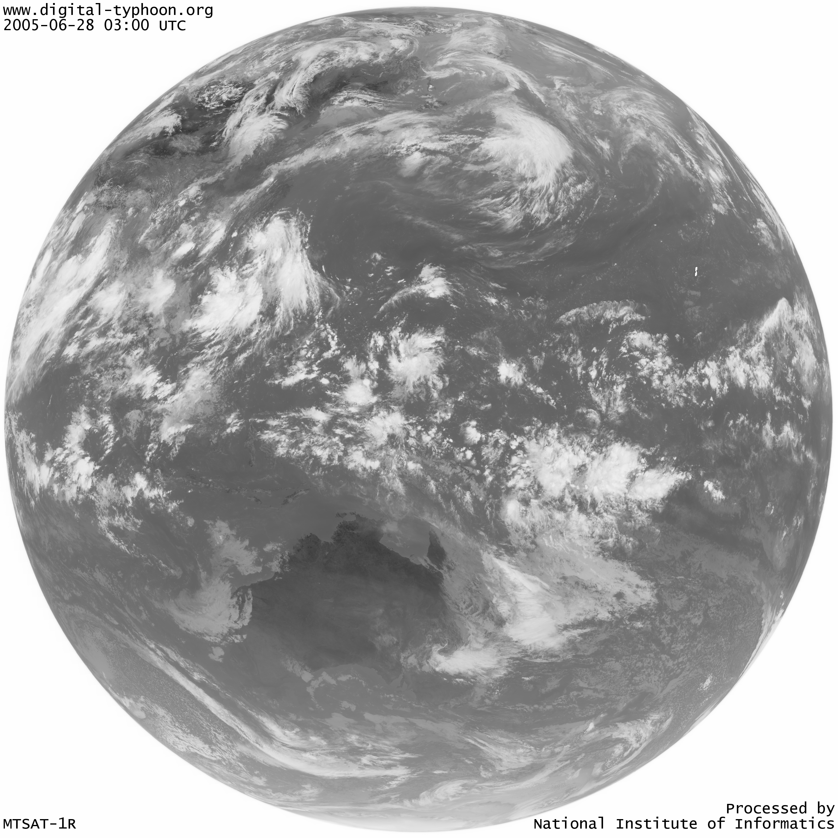
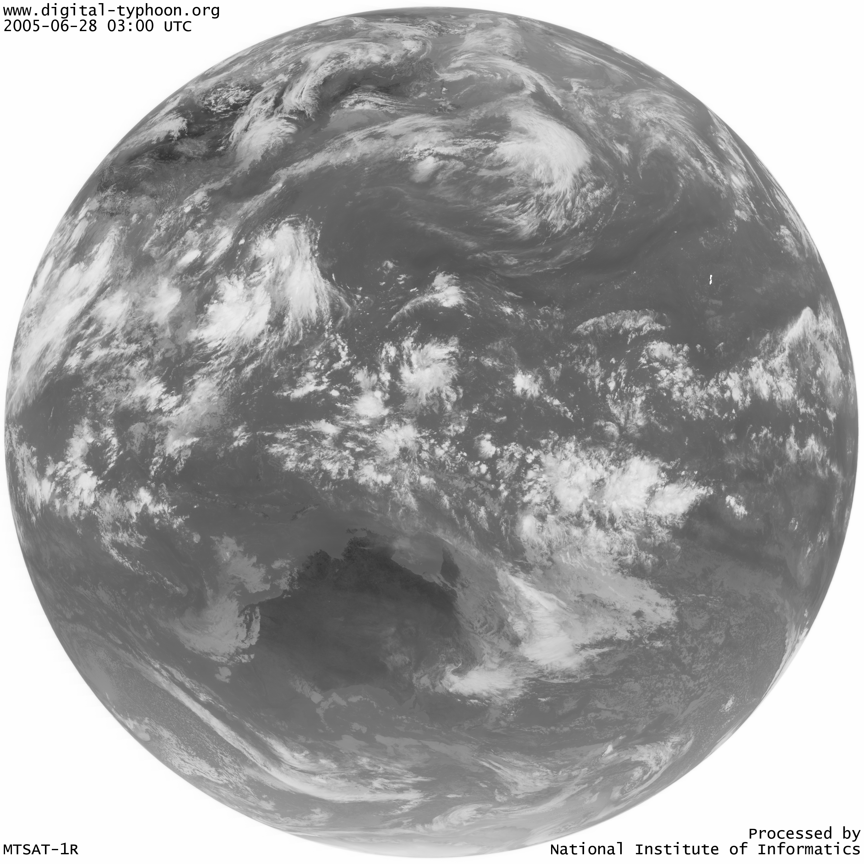
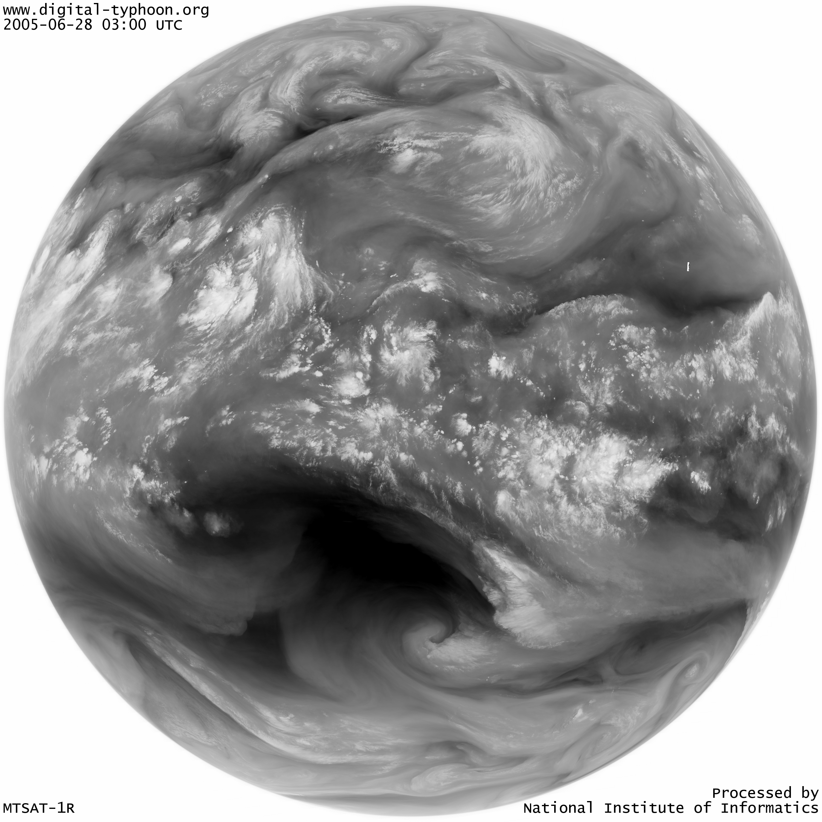
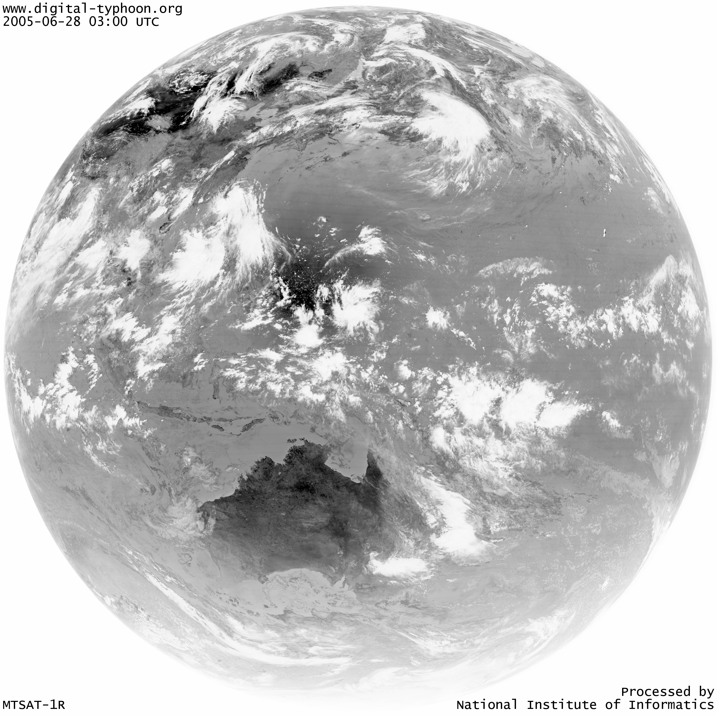
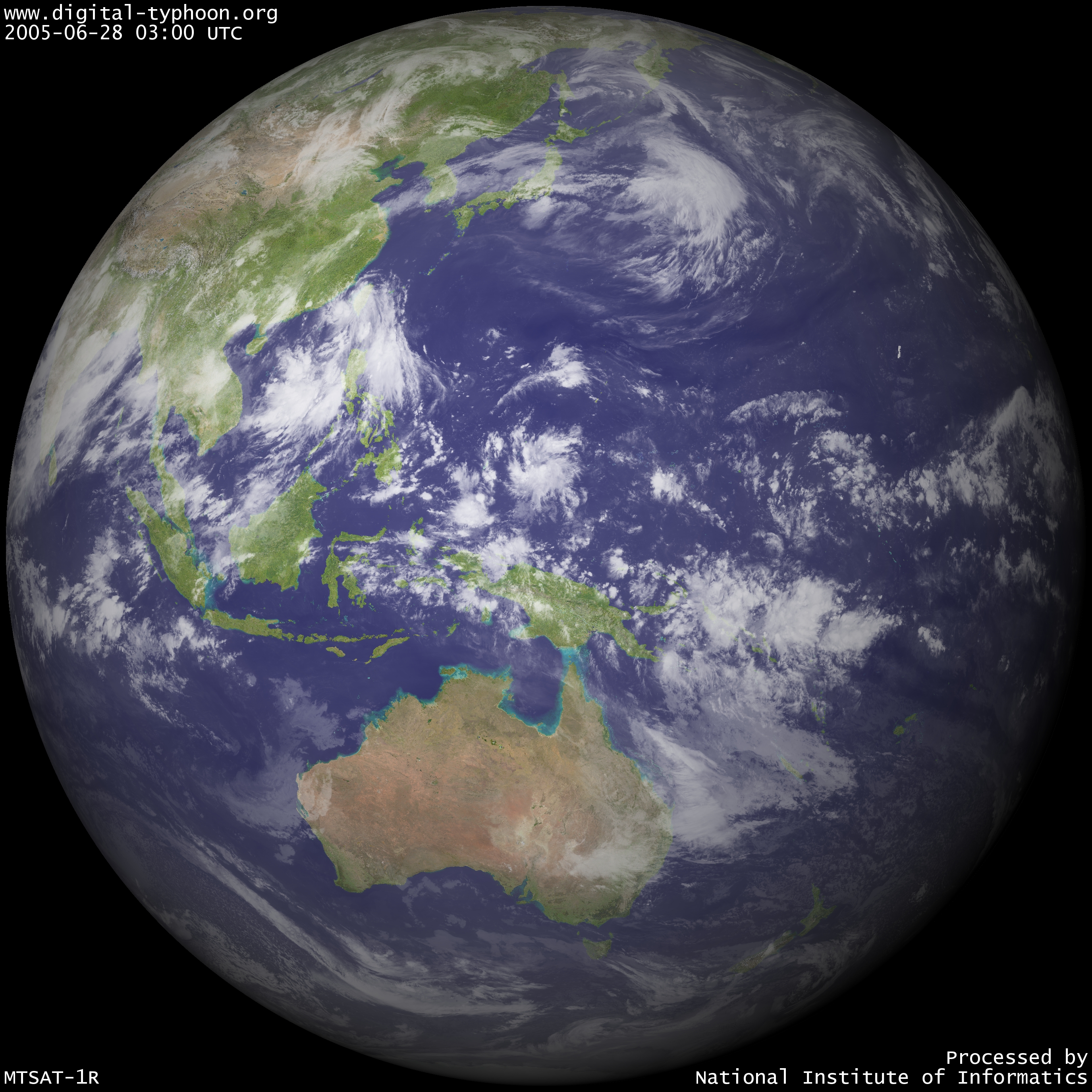
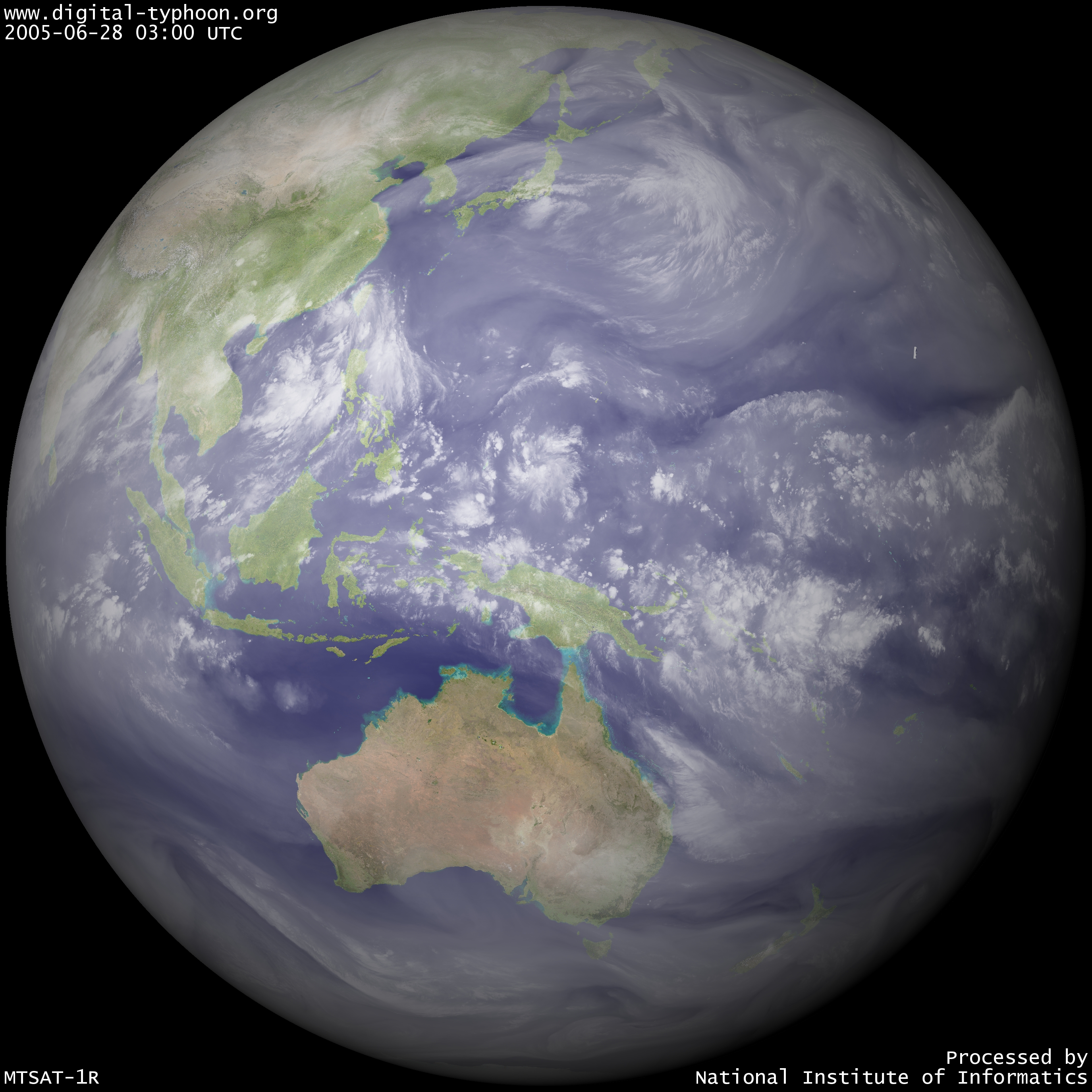
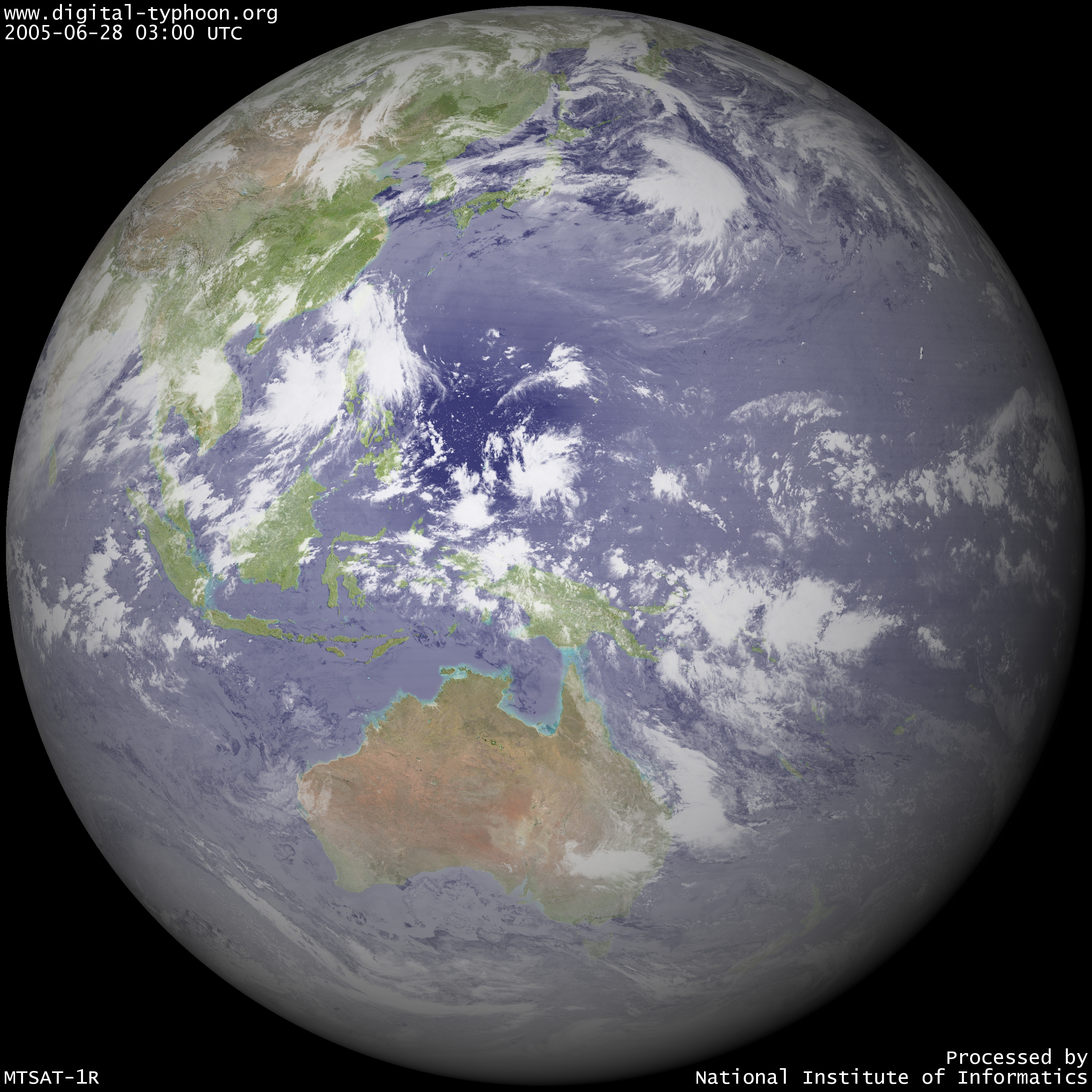
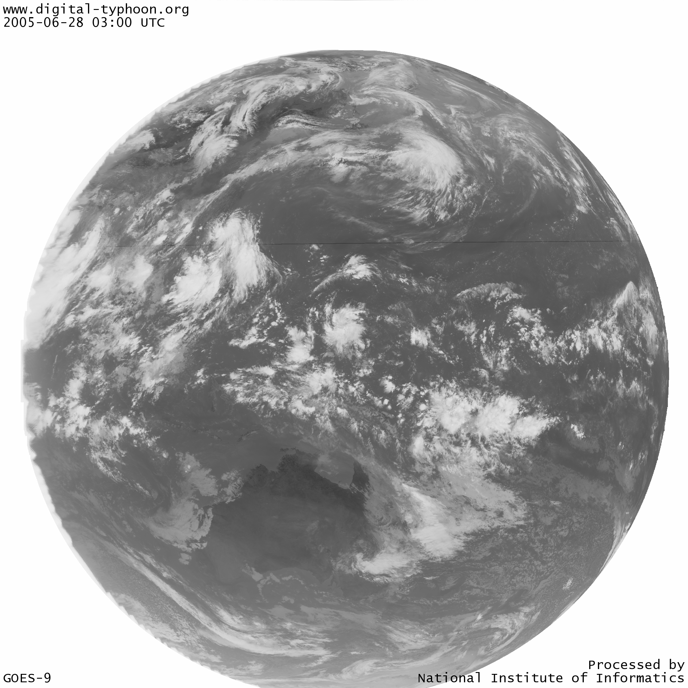
2005-06-28
About Himawari-6 Satellite and the Period of Transition
Starting from 0300 UTC on June 28, 2005, the geostationary meteorological satellite of Japan will change from GOES-9 to Himawari-6 (MTSAT-1R). The following images are the first images we received.
We have a transition plan as follows.
-
Infrared imagery
After checking the procedures of data dissemination, we will move to Himawari-6 as soon as possible.
-
Visible imagery
Japan Meteorological Agency and Japan Meteorological Business Support Center decided to "terminate the dissemination of visible imagery of Himawari-6" (*1). Due to this decision, we still do not have prospects for the acquisition of visible imagery. The dissemination of GOES-9 satellite imagery will continue until July 14, 2005, so we will use that dissemination, and, at the same time, look for other data providers for visible imagery.
In any case, the troubles of the system are expected in the transition phase, so please be patient for a moment.
Related Sites