|
Digital Typhoon: Total Solar Eclipse on July 22, 2009 |
|
|
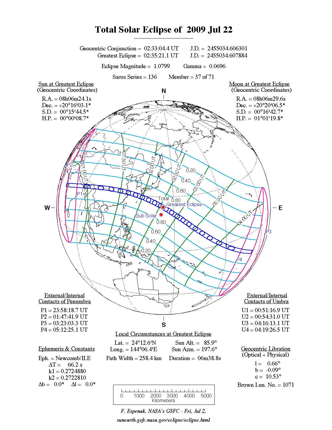
1. Total Eclipse on July 22, 2009
Realtime Data
'Himawari' Meteorological Satellite Imagery
This page is planned to provide a real-time relay from space for the total eclipse on July 22, 2009 using the geostationary meteorological satellite "Himawari." How images and videos from the ground site is different from those from the space? You can see an example of the image at Annular Solar Eclipse on August 22, 1998.
The unique point of the relay on this page is that the viewpoint is located at 35,800 km above ground, so you can see the solar eclipse for certain even when the weather is cloudy, rainy, or stormy with typhoons.
AMeDAS Sunshine Duration
AMeDAS is used not only for measuring rains and winds, but also for measuring sunshine duration at some stations. We may be able to observe the effect of eclipse as the change of sunshine duration, as long as the weather is good.
The following is the list of AMeDAS stations within the central phase, or the percentage of diameter (magnitude) is more than 98%. Those includes stations at Tanegashima, Yakushima, Tokara Islands (Nakanoshima), Kikaijima, Amami Oshima, Ogasawara Islands, Tokunoshima, Oosumi Peninsula and Satsuma Peninsula.
The magnitude of solar eclipse is studied using Local Prediction of Solar Eclipse provided by National Astronomical Observatory of Japan (NAOJ).
2. Links