|
Digital Typhoon: 2022 Hunga Tonga-Hunga Haʻapai Eruption |
|
|
1. Himawari-8 Satellite Images / Videos
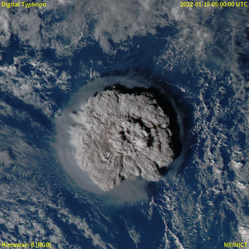
Himawari-8 satellite images of the eruption of Hunga Tonga-Hunga Haʻapai, which started an volcanic eruption in January 15, 2022.
From January 15 to January 16 2022, Visible Color Video
This movie captures the radius of 500 kilometers centered at 20.3S and 175.2W. The Himawari-8 visible images are mapped using Lambert Azimuthal Equal-Area projection.
KML file for January 15, 2022 is also available. You can see the data on a tool such as Google Earth.
January 17 2022, Visible Color Video
Comparison with 2021 Fukutoku-Okanoba Submarine Eruption
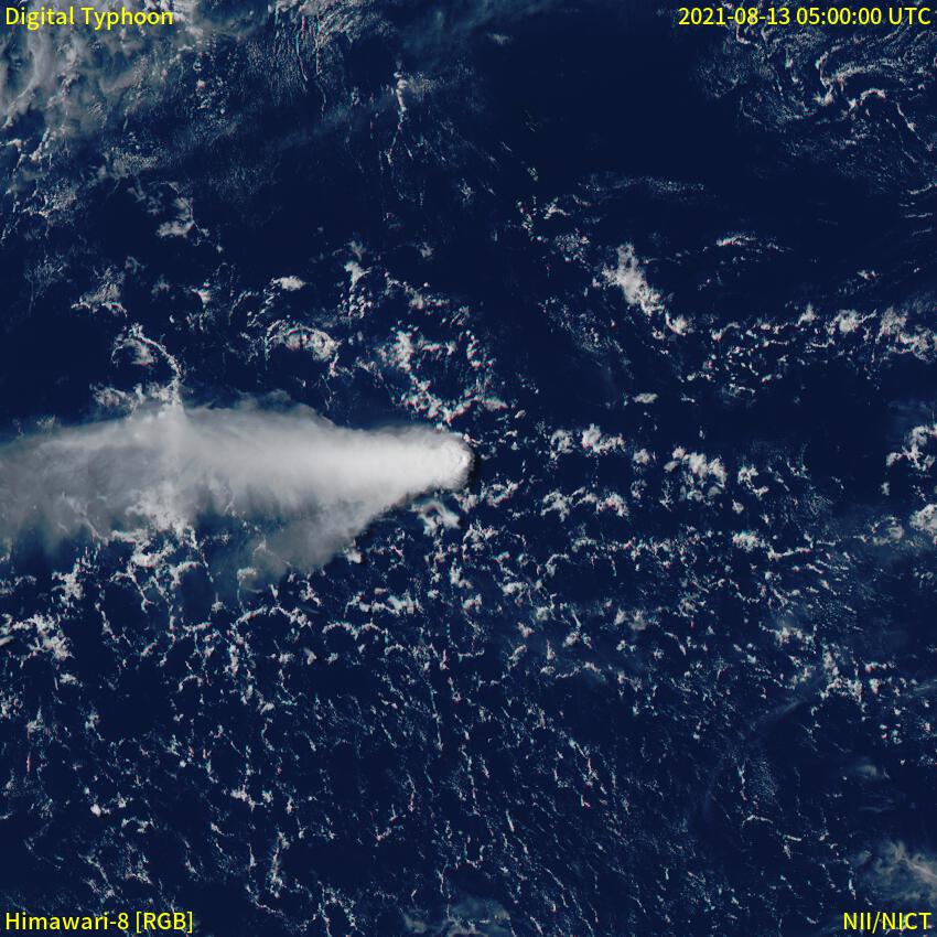
The following images are the comparison in the same scale between this eruption and 2021 Fukutoku-Okanoba Submarine Eruption, which is a large-scale eruption near Japan. Both images show the area of 500km radius centered at the volcano.
|
2022 Hunga Tonga-Hunga Haʻapai Eruption
|
2021 Fukutoku-Okanoba Submarine Eruption
|
|
|
|
05 UTC, January 15, 2022
|
05 UTC, August 13, 2021
|
Weather Satellite "Himawari-8" Images / Videos
Earthquake and Tsunami Information
Other Information