| 赤外1 | 赤外2 |
|---|---|
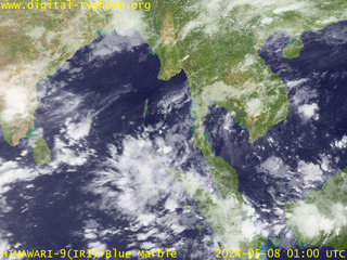 |
 |
| 赤外3 | 赤外4 |
 |
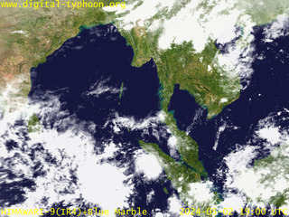 |
| ||||||||||||
| ||||||||||||
|
このページでは、東南アジアから南アジアを中心に、タイ・ラオス・カンボジア・ベトナム・マレーシア・シンガポール・インドネシア・ミャンマー・バングラデシュ・インド・スリランカなどを含む範囲の気象衛星画像を提供します。
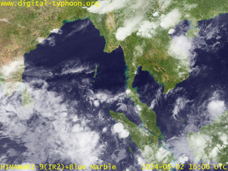
| 赤外1 | 赤外2 |
|---|---|
|
|
| 赤外3 | 赤外4 |
|
|
北部インド洋のベンガル湾にはサイクロンが発生し、インドやバングラデシュなどに災害を引き起こします。これに関する情報は以下のページをご覧ください。
本ページはもともと、スマトラ沖地震への対応として開設されたものです。2004年12月26日の00:58:53 UTCにスマトラ島沖で発生した大地震により、最大30mを越える高さの大津波がインド洋周辺の各国を襲ったことにより、死者行方不明者が約30万人、被災者が数百万人という、未曾有の規模の災害が発生しました。さらに津波によって被害を受けた地域は、雨に対する備えが脆弱となっており、豪雨やサイクロンによる被害の拡大も懸念されています。そこで、北部インド洋の気象衛星画像をこの特設ページで提供し、この地域の気象の監視に貢献したいと考えています。
このページで提供する気象衛星画像は、ゴーズ9号で観測した(白黒の)赤外画像を、NASAが提供するBlue Marble データに重ね合わせた画像です。ゴーズ9号の場合、東南アジアからインド・スリランカにかけての地域は観測地域の端に相当するため、実質的な解像度が粗くなっていることに注意して下さい。なお、この地域の観測に最も適した気象衛星は、赤道上空東経63度に位置するMETEOSAT-5です。
United States Geological Survey(米国地質調査所)による地震情報。
http://earthquake.usgs.gov/eqinthenews/2004/usslav/
QuickBird衛星画像を用いた津波被害の解析。日本語での情報提供。
http://www.digitalglobe.com/tsunami_gallery.html
IKONOS衛星画像を用いた津波前後の比較。
http://www.spaceimaging.com/gallery/tsunami/
SPOT衛星画像から作成した、津波と地震前後の変化に関する画像。
http://www.spotimage.fr/html/_167_240_241_781_.php
OrbView-3衛星で撮影した津波前後の画像。
http://www.orbimage.com/news/featuredimage.html
スリランカを襲った津波に関する地図・衛星データ集。南アジアの地図・衛星データ集もあり。
http://www.disastercharter.org/disasters/CALLID_078_e.html
津波で影響を受けた地域を各種衛星が撮影した画像。シンガポール国立大学。
http://www.crisp.nus.edu.sg/tsunami/tsunami.html
National Geophysical Data Center (NGDC)による地震データと衛星画像の解析。
http://www.ngdc.noaa.gov/spotlight/tsunami/tsunami.html
各種衛星が撮影した津波関連衛星画像とその他のデータ。
http://earthobservatory.nasa.gov/NaturalHazards/natural_hazards_v2.php3?img_id=12657
津波が引き起こした惨事の写真と映像。
http://www.waveofdestruction.org/
Flickr に集まった津波関連画像。
http://www.flickr.com/photos/tags/tsunami
スマトラ沖大地震の奇しくも1年前の同じ日(2003年12月26日)に発生したイラン南東部地震で壊滅的な被害を受けたバムも、復興には長い時間を要している。
http://dsr.nii.ac.jp/bam/
|