| February 7, 2009 03 UTC - 14 Local Time | 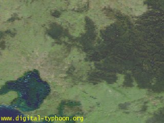 |
|---|---|
| February 7, 2009 04 UTC - 15 Local Time | 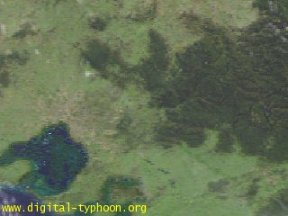 |
| February 7, 2009 05 UTC - 16 Local Time | 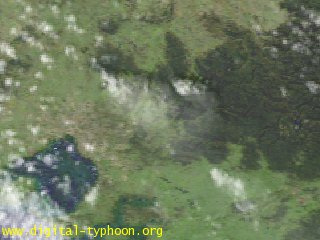 |
| February 7, 2009 06 UTC - 17 Local Time | 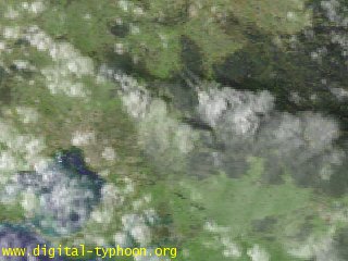 |
| February 7, 2009 07 UTC - 18 Local Time | 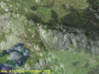 |
| ||||||||||||
| ||||||||||||
|
Bushfires across the Australian state of Victoria in February 2009 occurred during a serious heat wave. The death toll makes them the deadlist fires in Australia's recorded history, at least 209 deaths.
In the following, we observe the occurrence of these bushfires on February 7 on the visible imagery of meteorological satellite "Himawari."
| February 7, 2009 03 UTC - 14 Local Time |  |
|---|---|
| February 7, 2009 04 UTC - 15 Local Time |  |
| February 7, 2009 05 UTC - 16 Local Time |  |
| February 7, 2009 06 UTC - 17 Local Time |  |
| February 7, 2009 07 UTC - 18 Local Time |  |
This image is generated by meteorological satellite "Himawari" visible imagery overlayed on NASA Blue Marble. The blue region in the bottom left (southwest) is Port Phillip Bay, and the city of Melbourne is located at the north of this bay. It is reported that bushfires are occurring mainly in north of Melbourne, in addition to east to west of Melbourne (Reference: Related links). In the following, we will track the change of the fire using the series of images shown above, but the time-series change can be easier to see as animation of Google Earth using the KML file above.
In the beginning, on the image of 14 LT, this area around Melbourne was very clear without any clouds. This day was an extremely hot day, reaching 46.4 degree Celsius at Melbourne, which is the hottest temperature on record since 1855. This time the image does not show any white pixels, On the image of 15 LT, however, we can see a small white region in north of Melbourne. This white region became larger on the image of 16 LT, extending toward right bottom with a light white color. What is this?
Usually white regions on visible imagery mean clouds, and you can see other white regions the image of 16 LT. Most of them take rounded shapes (probably they are cumulus clouds), but the white region in question takes a "carrot-like" shape, in contrast, and takes a light white color while becoming wider. Takes other information into consideration, this white region represents plume of fires rather than clouds. Comparison between this location and the map suggests that this plume is from the site of Kinglake west (or Kilmore). It is reported that 12 people were killed by fire in this area.
In addition, we can see another fire on the image of 16 LT near the center. Comparison between this location and the map suggests that this plume is from the site of Murrindindi. This area was devastated by fire, including Marysville where almost all the houses were burnt down.
The plume increased further on the image of 17 LT, indicating that the intensity of fires has increased. On the other hand, the plume seems to be less on the image of 18 LT, but this is because of the darkness in the evening, not indicating the decrease of plume. After that in the night, visible imagery cannot be used for observation, so we stop the images on 18 LT.
On February 8, the next day of the fire, it is difficult to observe the fire on satellite images because this area is covered by clouds with some rains in Melbourne.
The latest news, photographs and videos on the site, are collected most in the websites of Auatralia's mass media. These websites are accessible from Google News (Australian edition). The overview of bushfires is also frequently updated at English Wikipedia. Other sources of information are collected in the following.
|