|
デジタル台風:2022年フンガ・トンガ=フンガ・ハアパイ噴火 |
|
|
1. ひまわり8号衛星画像/動画
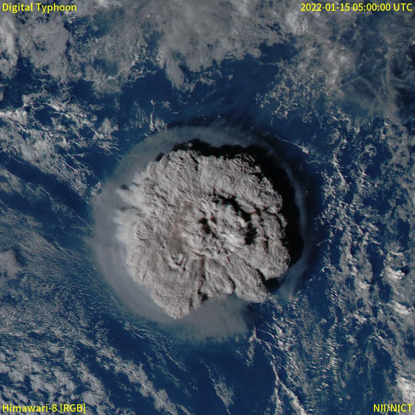
フンガ・トンガ=フンガ・ハアパイ火山で2022年1月15日に始まった噴火の噴煙の様子を捉えたひまわり8号衛星画像を提供します。また、噴火からおよそ半日かけて日本付近に到達した津波(潮位変動)に関しては、津波情報をご覧くだい。
2022年1月15日〜1月16日 可視カラー動画
南緯20.3度、西経175.2度を中心に、半径500kmの範囲を捉えた動画です。ひまわり8号可視画像を、ランベルト正積方位図法で地図投影し作成しました。
2022年1月15日のKMLファイルを用意しました。Google Earthなどで閲覧できます。
2022年1月17日 可視カラー動画(拡大)
南緯20.3度、西経175.2度を中心に、半径150kmの範囲を捉えた動画です。ひまわり8号可視画像を、ランベルト正積方位図法で地図投影し作成しました。前日の画像よりも拡大していることにご注意下さい。
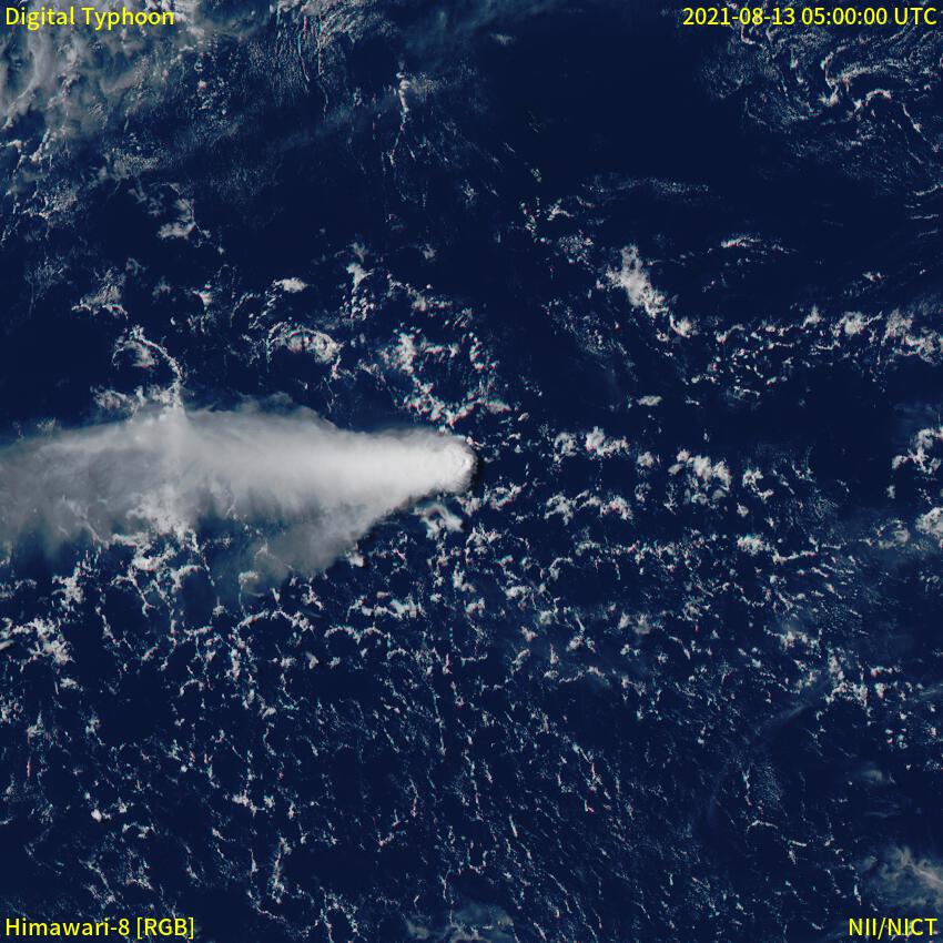
2021年福徳岡ノ場海底火山噴火との比較
日本周辺の大規模噴火であり、各地への軽石の漂着が問題となった、2021年福徳岡ノ場海底火山噴火と今回の噴火を同じスケールで比較しました。両方の画像とも、火山を中心として、半径500kmの領域を表示しています。
|
2022年フンガ・トンガ=フンガ・ハアパイ噴火
|
2021年福徳岡ノ場海底火山噴火
|
|
|
|
2022年1月15日5時(UTC)=2022年1月15日14時(JST)
|
2021年8月13日5時(UTC)=2021年8月13日14時(JST)
|
気象衛星ひまわり8号画像/動画
地震/津波情報
その他の情報