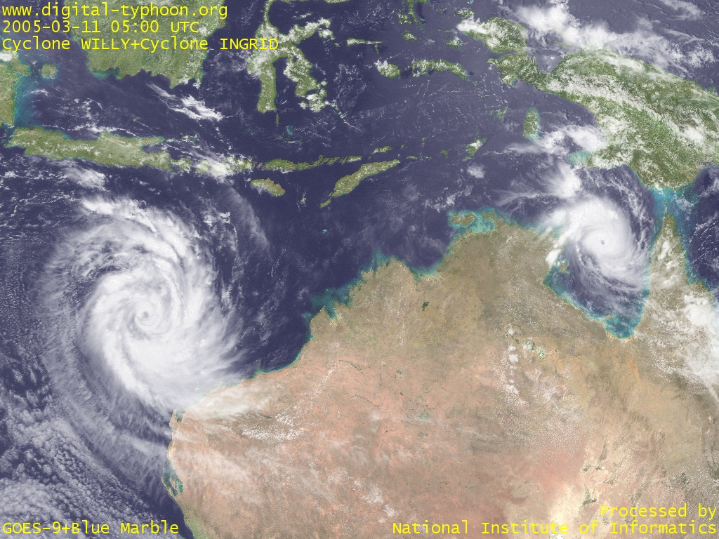
 Cyclone WILLY in its intensification (left) and Cyclone INGRID in its re-intensification (March 11, 2005, 0500 UTC)
|
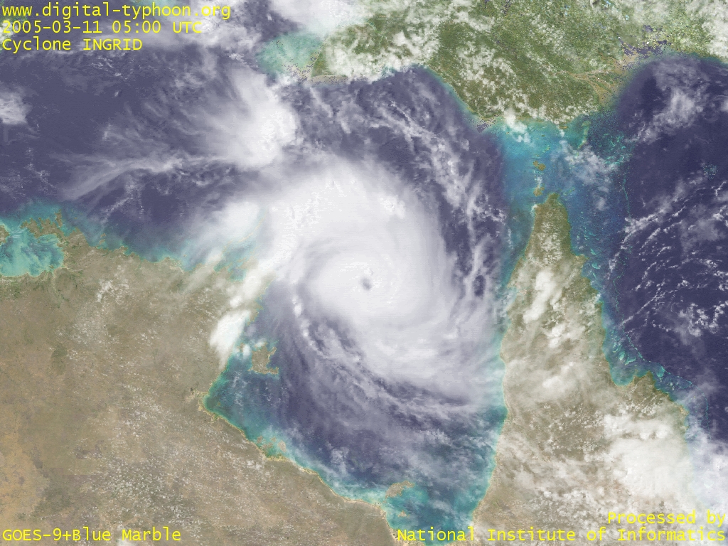 Cyclone INGRID magnified (March 11, 2005, 0500 UTC)
|
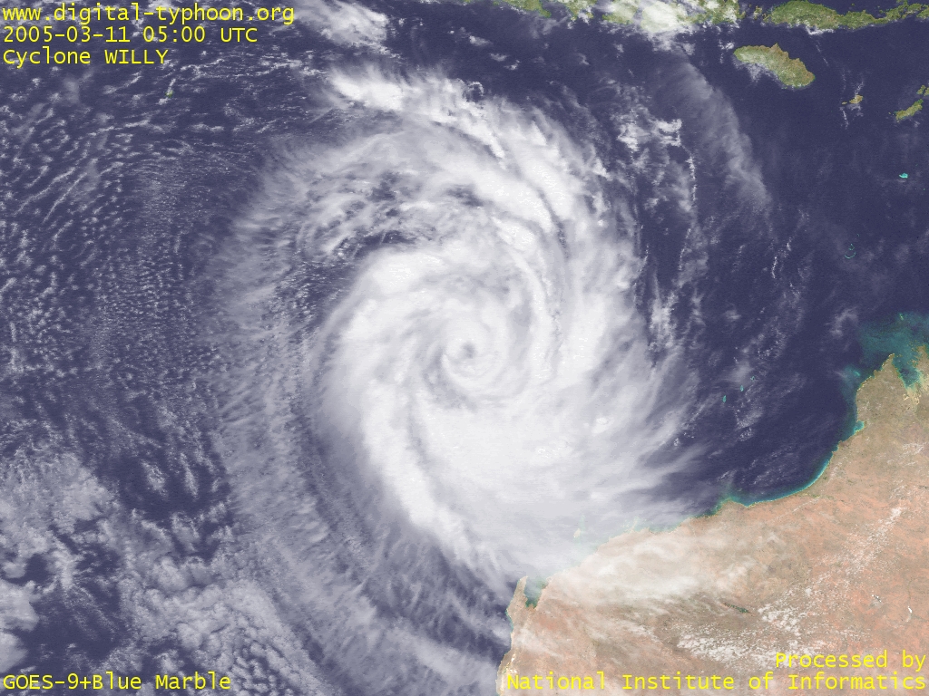 Cyclone WILLY magnified (March 11, 2005, 0500 UTC)
|
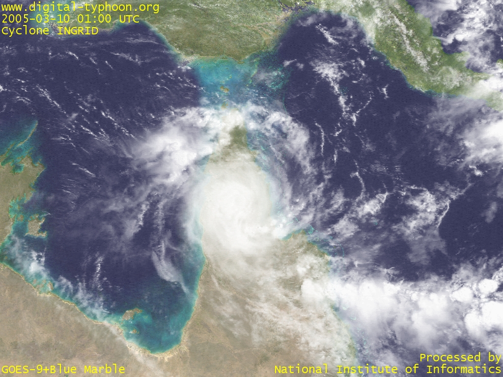 Cyclone INGRID just crossing Cape York Peninsula (March 10, 2005, 0100 UTC)
|
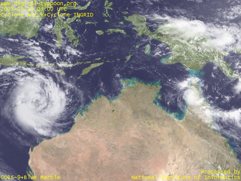 A large vortex of Cyclone WILLY (left) and a mini vortex of Cyclone INGRID (March 10, 2005, 0300 UTC)
|
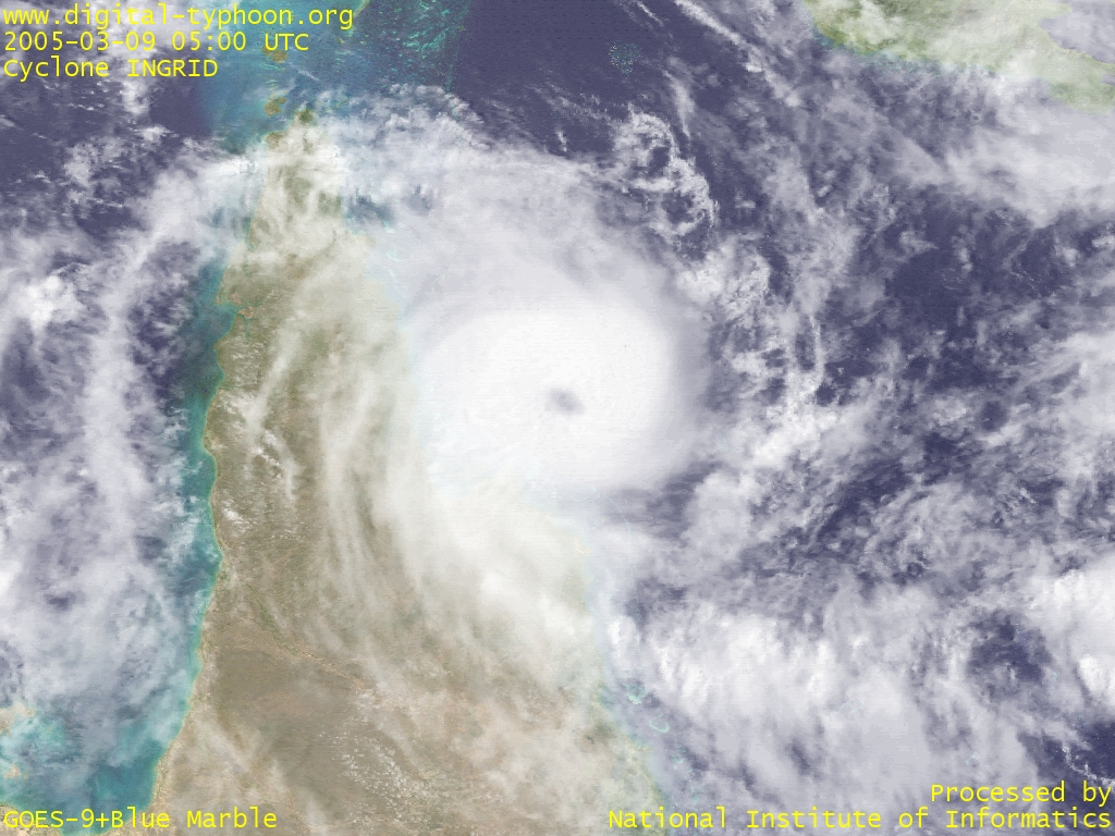 Cyclone INGRID weakening with its eye getting unclear (March 9, 2005, 0500 UTC)
|
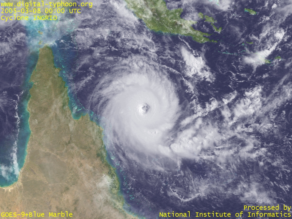 Cyclone INGRID approaching to the northern part of Australia (March 8, 2005, 0000 UTC)
|
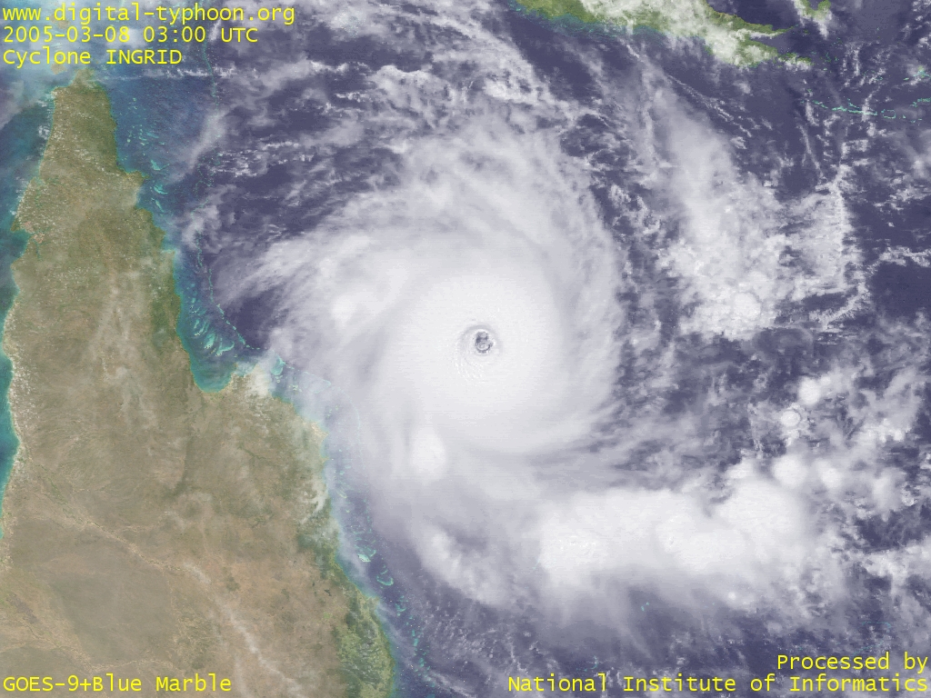 The core of Cyclone INGRID (March 8, 2005, 0300 UTC)
|
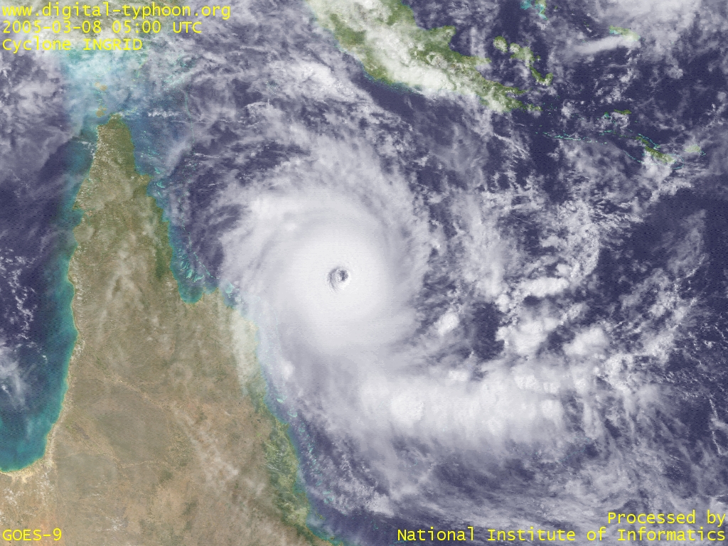 Cyclone INGRID with its clearly visible eye (March 8, 2005, 0500 UTC)
|
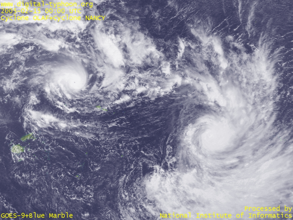 Two Cyclones in the South Pacific: Cyclone OLAF (top left) and Cyclone NANCY (bottom right) (February 15, 2005, 0000 UTC)
|
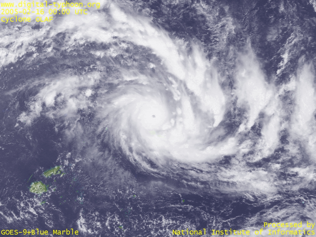 Cyclone OLAF at its peak of maturity near Samoa (February 16, 2005, 0000 UTC)
|
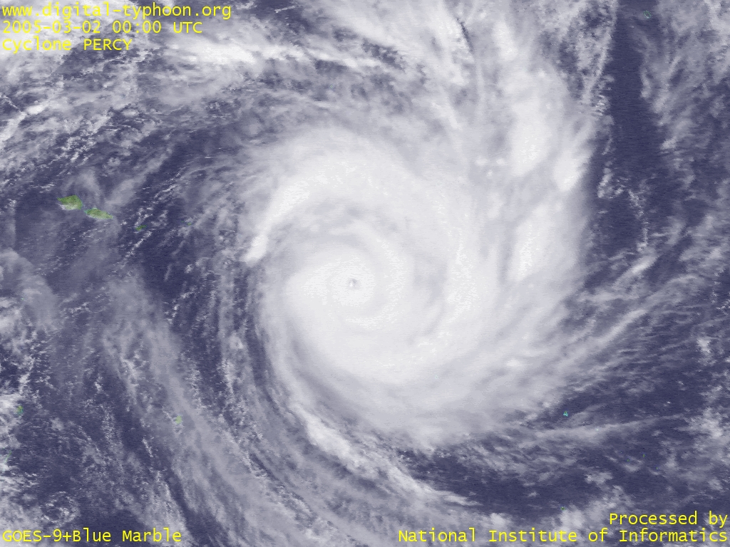 Cyclone PERCY at its peak of maturity in north of Cook Island (March 2, 2005, 0000 UTC)
|
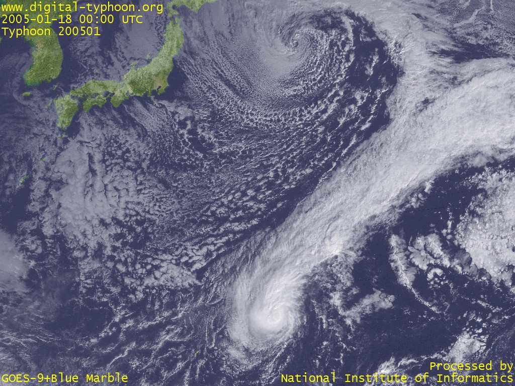 Typhoon KULAP being pushed toward northeast (0000 UTC)
|
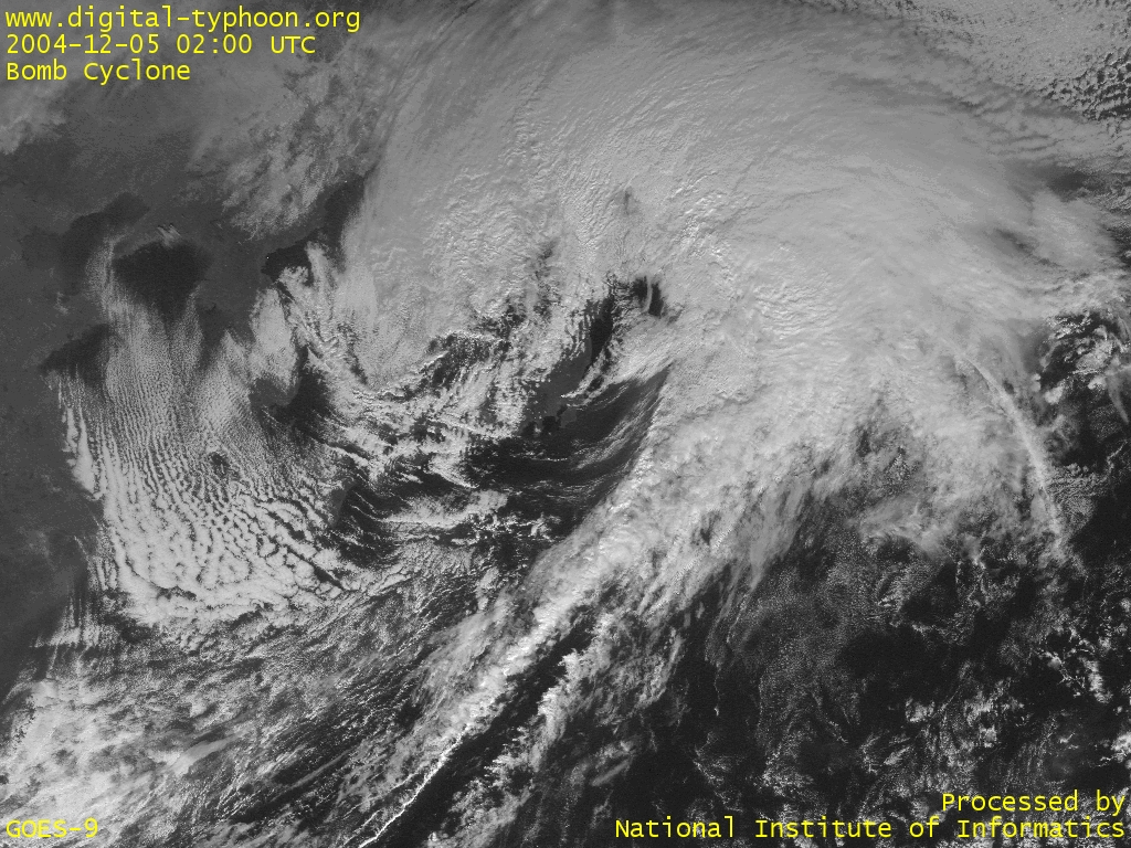 A bomb cyclone that absorbed Typhoon NANMADOL (0200 UTC)
|
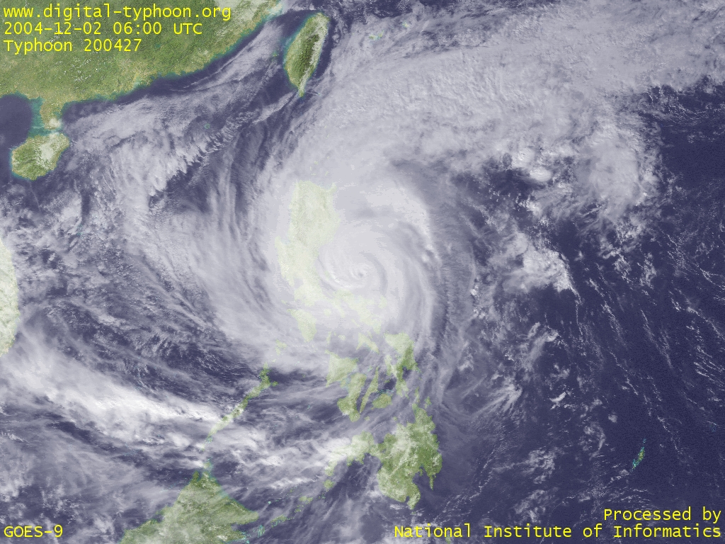
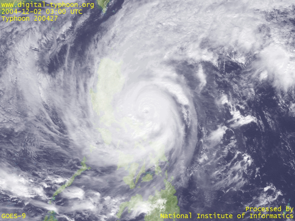 Typhoon NANMADOL approaching Philippines (0300 UTC)
|
 Typhoon NANMADOL maintaining its spiraling clouds (0600 UTC)
|
 Typhoon NANMADOL with thick clouds packed around the center (0300 UTC)
|
 Typhoon NANMADOL started intensification (0600 UTC)
|
 Typhoon MUIFA with its eye getting visible (0500 UTC)
|
 Typhoon MUIFA whose center is uncertain in the row of big cloud clusters (0300 UTC)
|