|
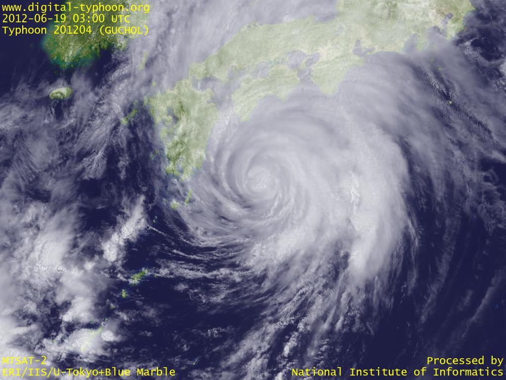
2012年06月19日 22:00 JST
台風4号(GUCHOL)は17時過ぎに和歌山県南部に上陸し、紀伊半島東岸に沿って北上したあと伊勢湾に抜け、20時過ぎに愛知県東部に再上陸しました。6月に台風が上陸するのは台風200406号以来8年ぶりとのことです。
この台風は中心の北東側に非常に強い雨雲を伴っており、レーダー画像を見ていても、台風の東側にあたる静岡県内での大雨が顕著となっています。愛知県や静岡県の河川を中心に増水も続いていますので、国土交通省 川の防災情報などを使って最新の水位を確認して下さい。風速についても静岡県の風が強くなっており、御前崎で20:43に最大瞬間風速41.4m/sを記録しました。台風の東側の関東地方も、中心からはやや離れているものの、夕方からは強い風雨に見舞われています。ただし台風は北東に65km/hと速いスピードで移動しているため、大雨が長雨として続くというパターンではなく、累積雨量よりも短時間雨量の方に警戒が必要という感じです。
2012年06月19日 14:30 JST
台風4号(GUCHOL)は四国の南にまで北上してきました。これまでのところ風雨が強い進行方向右側の領域がずっと海上を進んでいるため、南大東島で最大瞬間風速38.8m/sを記録した以外は、あまり強風は記録されていません。むしろ 雨雲レーダーによると、西日本には台風の進行方向前面に広がる雨雲がすでにかかっており、 リアルタイムアメダス降水量マップや イベント検出によると、特に宮崎県や兵庫県で雨量が大きくなっている場所があります。今後は台風がさらに接近してきますので、紀伊半島や東海地方で雨が強まるとともに、急に風が強まるところもありそうです。
2012年06月19日 08:00 JST
台風4号(GUCHOL)は南西諸島から遠ざかり、四国に接近しつつあります。今のところそれほど大きな被害のニュースは入っていないようですが、これは風雨の強い領域が海上を進んで南西諸島にあまりかからなかったという要因もありますので、今後台風が陸地に接近すると、急に風雨が強まるところも出てくるでしょう。
なお、ソーシャルメディアを活用した台風情報の試みとして、ツイッターについてはふってきったー(たいふう版)と、フェイスブックについてはFacebook公式ページを公開しました。ただしフェイスブック版については試行錯誤が続いており、今はまだ試験運用といった段階です。それぞれのメディアに適した情報提供・共有のしくみを考えていこうというのが最終的な目的です。
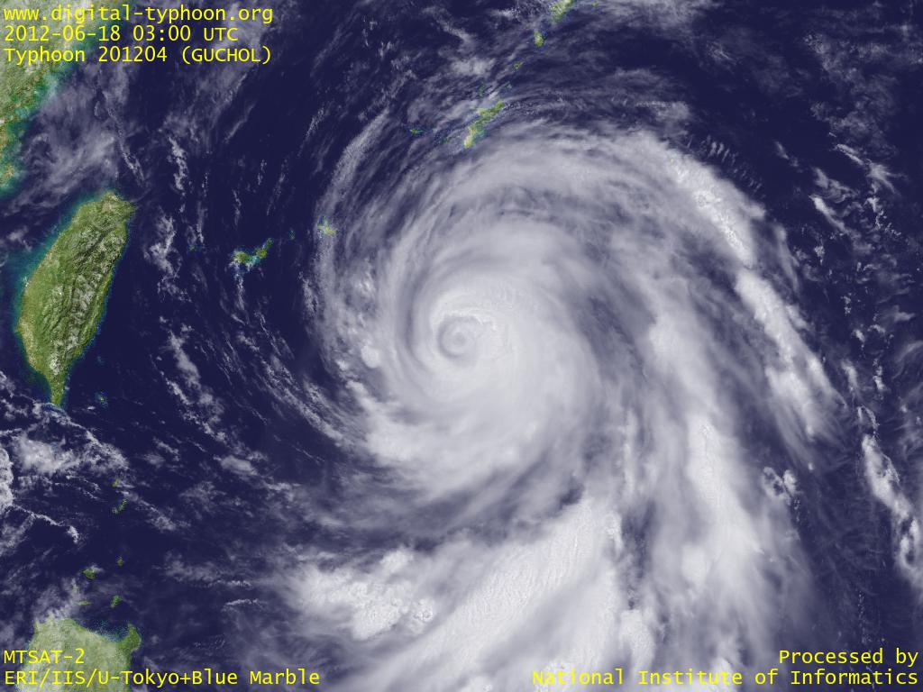
2012年06月18日 18:00 JST
台風4号(GUCHOL)は沖縄に接近しつつあり、各地がすでに強風域に入りつつあります。 雨雲レーダー画像でも台風の雨雲の形が鮮明となり、 アメダス風向・風速マップでも台風の周辺の風向きが見えるようになってきました。この台風は 台風201203号と同様に沖縄本島と大東島地方の間を抜けていくとの見通しですが、その後もあまり進路を変えずに北北東に進むとの予報が出ており、上陸の可能性が高まりつつあります。
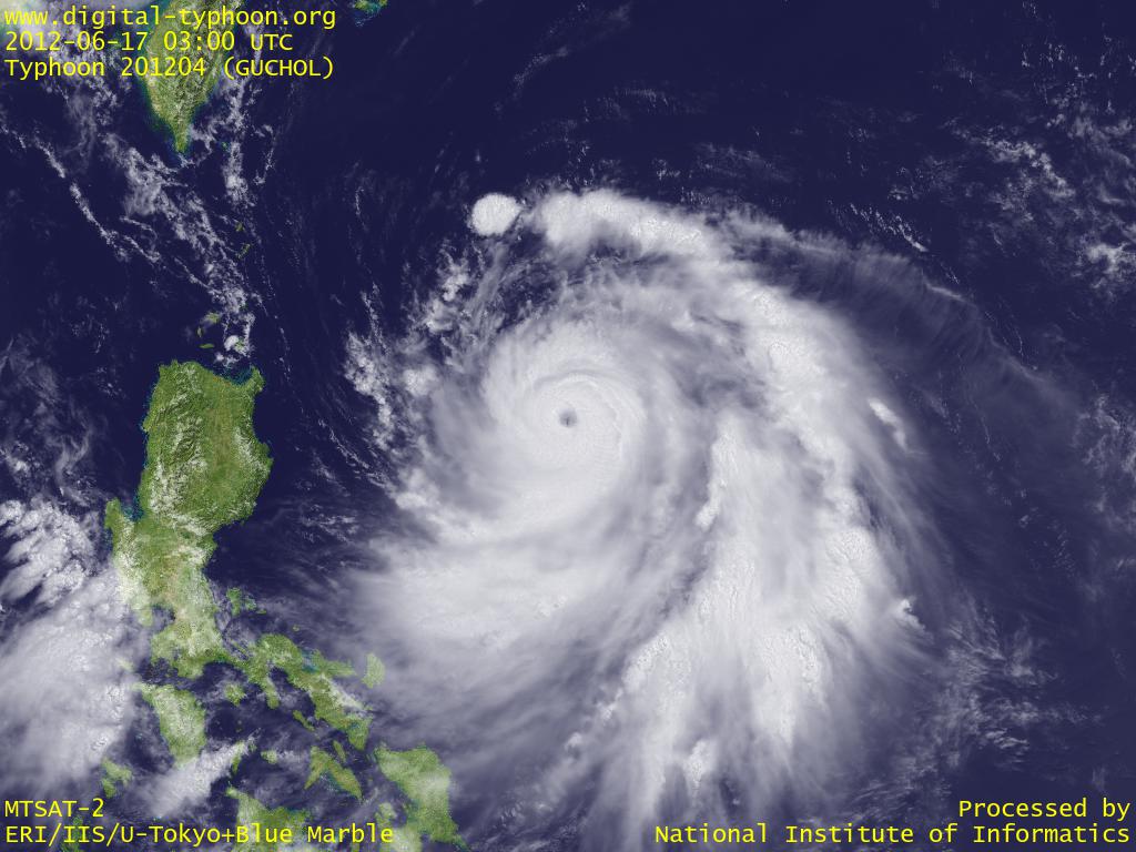
2012年06月17日 14:00 JST
台風4号(GUCHOL)はフィリピン東方で北上を続けており、非常に強い台風にまで発達してきました。今後、猛烈な台風にまで発達する可能性も出てきています(参考: 台風の階級)。台風の今後の進路は南西諸島南方から九州南方へ、さらには四国、本州の南岸を進む(上陸の可能性もあり)と予報されており、日本付近の梅雨前線とも重なって、今後の大雨への警戒が必要な状況となってきました。
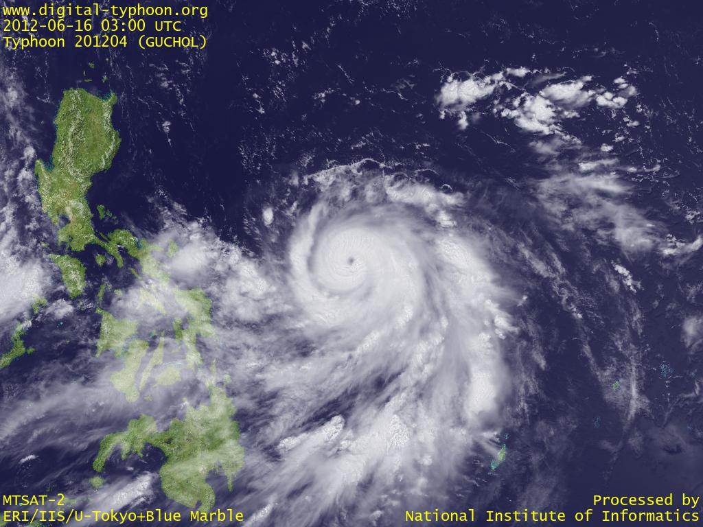
2012年06月16日 14:30 JST
台風4号(GUCHOL)がフィリピン東方で進行方向を変えて北上を開始しました。中心付近には眼も見えてきて、雲の形も整い、発達期に入ってきていることがわかります。今後は南西諸島に徐々に接近しつつ、しばらくの間は発達しそうです。
2012年06月12日 16:30 JST
台風4号(GUCHOL)がカロリン諸島で発生しました。しばらくは太平洋上を北北西に進み、グアムとヤップの間を通り抜けていくという予報が出ています。ちなみにこの台風の名前は、これから台風が接近するヤップの言葉だそうです。
関連する台風ブログ記事
- 2011年台風15号(ロウキー|ROKE)
- 2011年台風2号(ソングダー|SONGDA)
- 2011年台風1号(アイレー|AERE)
- 2004年台風6号(ディアンムー|DIANMU)
- 2015年台風6号(ノウル|NOUL)
- 2017年台風21号(ラン|LAN)
- 2022年台風15号(タラス|TALAS)
- 2004年台風16号(チャバ|CHABA)
- 2004年台風23号(トカゲ|TOKAGE)
- 2022年台風8号(メアリー|MEARI)
|