|
2012年08月16日 18:30 JST
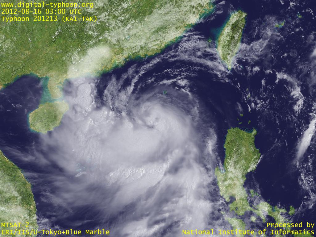
台風13号(KAI-TAK)はフィリピンを通過して南シナ海に入り、やや発達してきました。台風の前面にも強い雲が広がっており、それがすでに中国の広東省南部や海南島にかかりつつあります。この台風は当初は台湾方面に進むとの予報でしたが、どんどん進路が南方にずれて、現状ではベトナム北部方面に進むとの予報に変わっています。
2012年08月15日 13:00 JST
台風13号(KAI-TAK)はフィリピンのルソン島北部に上陸しました。この台風は中心がなかなか定まらず、中心位置の精度も低くなっていましたが、徐々に形を整えつつあるようです。そして中心の西側から南側に強い雨雲を伴っているため、ルソン島北部を中心に大雨となっているようで、すでに死者2人という報告があります。今後台風は南シナ海に入って、香港周辺の広東省に接近するとの予報が出ています。
2012年08月13日 23:30 JST
台風13号(KAI-TAK)がフィリピンの東で発生しています。今後、台風は北西に進んで台湾付近に接近するとの予報が出ています。
関連する台風ブログ記事
- 2013年台風11号(ウトア|UTOR)
- 2013年台風19号(ウサギ|USAGI)
- 2008年台風12号(ヌーリ|NURI)
- 2004年台風7号(ミンドゥル|MINDULLE)
- 2008年台風14号(ハグピート|HAGUPIT)
- 2009年台風2号(チャンホン|CHAN-HOM)
- 2010年台風2号(コンソン|CONSON)
- 2006年台風19号(シマロン|CIMARON)
- 2007年台風6号(パブーク|PABUK)
- 2009年台風17号(パーマァ|PARMA)
|