|
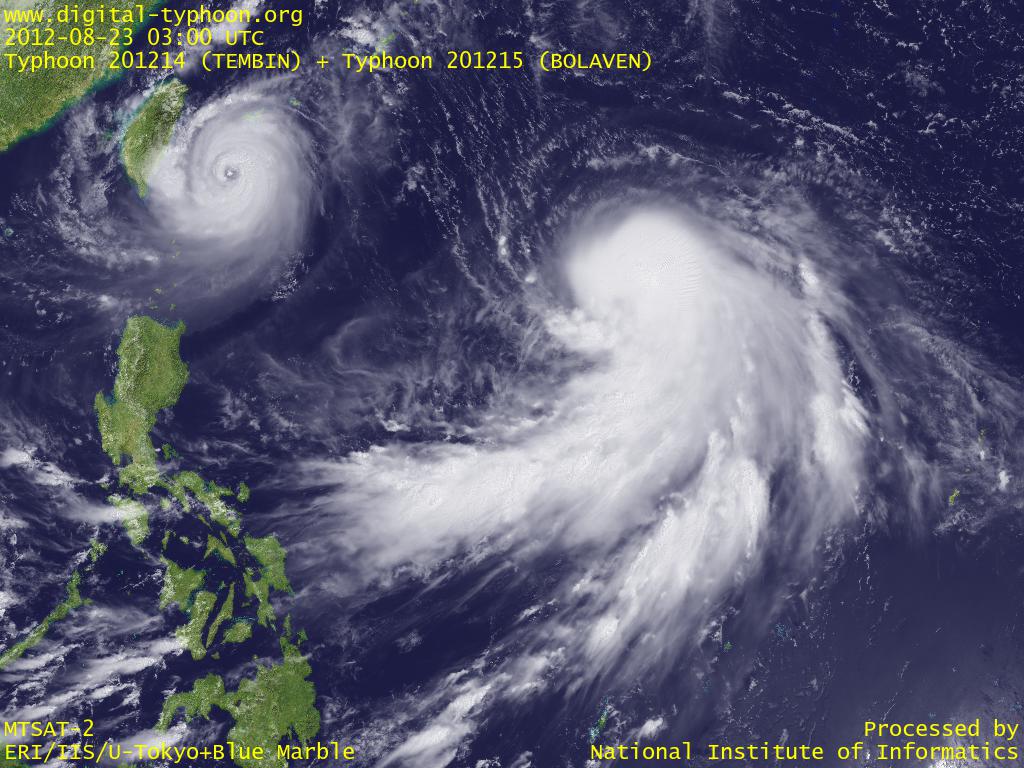
2012-08-23 18:30 JST
Typhoon BOLAVEN has large well-developed clouds around center, but its rotation has not become stronger, so its intensification has been stopped for a while. However, I think this typhoon will not end simply as a large cloud cluster as it looks now, and rotation will probably become stronger in the near future. And if that happens, it might reach the peak intensity as it draws near to Okinawa, so this is still a typhoon that needs to be watched with special attention.
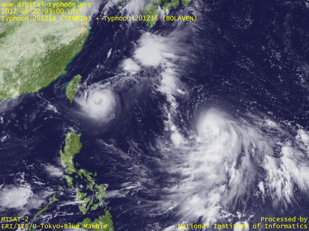
2012-08-22 17:30 JST
Typhoon BOLAVEN is showing a steady intensification, and its spiral shape has extended bigger as it absorbs clouds from the south. Its eye is still not clear on the visible satellite image, but it is forecast to continue its intensification, so preparation in advance is necessary in Okinawa which is on the forecast track.
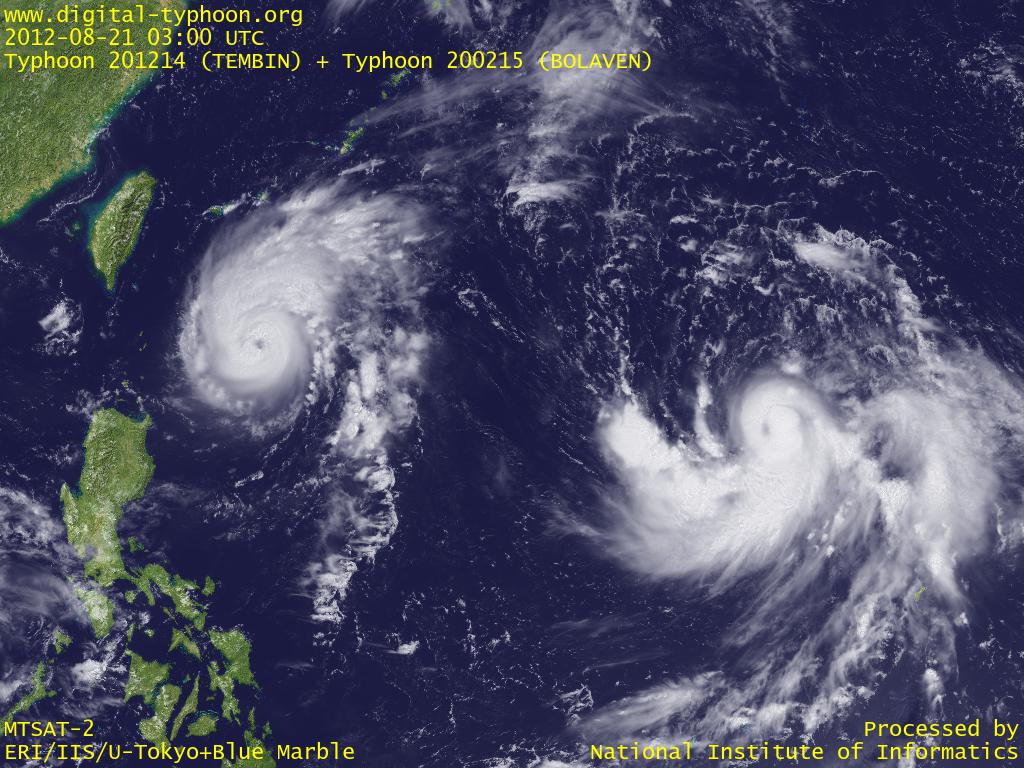
2012-08-21 18:30 JST
Typhoon BOLAVEN is moving northwest at this moment, but it is forecast to turn wmore west and increase its speed to draw near to Okinawa Islands. It is expected to have a track more north than Typhoon TEMBIN which may lead to approaching to one of the islands in Okinawa.
2012-08-20 16:30 JST
Typhoon BOLAVEN was formed in Mariana Islands. This typhoon is forecast to move west. This typhoon seems to satisfy favorable conditions for intensification, in a similar way to Typhoon TEMBIN, so we need to watch the development of the typhoon.
Related Typhoon Blog Entries
- Typhoon 200503 (SONCA)
- Typhoon 200815 (JANGMI)
- Typhoon 200422 (MA-ON)
- Typhoon 200424 (NOCK-TEN)
- Typhoon 200504 (NESAT)
- Typhoon 200406 (DIANMU)
- Typhoon 200704 (MAN-YI)
- Typhoon 200423 (TOKAGE)
- Typhoon 200922 (NIDA)
- Typhoon 200321 (LUPIT)
|