|
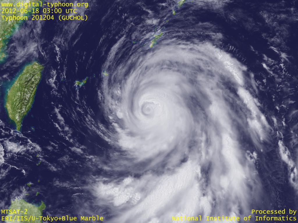
2012-06-18 18:00 JST
Typhoon GUCHOL is drawing near to Okinawa, and several places are already within the gale wind circle. Weather radar image shows the shape of typhoon clouds clearly, and AMeDAS wind maps shows the wind directions around the typhoon. This typhoon is forecast to pass between Okinawa main island and Daitojima region, and will keep its direction to NNE, suggesting that the probablility of making landfall is getting higher.
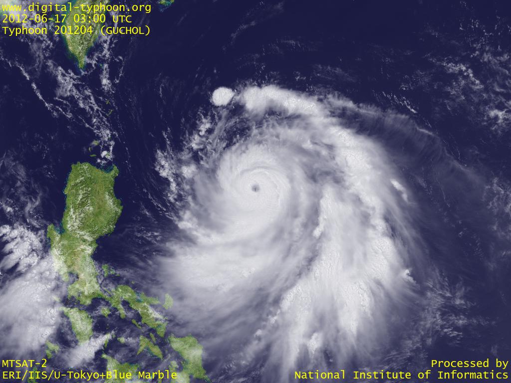
2012-06-17 14:00 JST
Typhoon GUCHOL is moving north off the east coast of Philippines, and has intensified into the category of very strong typhoon. It is likely to intensify more to the category of violent typhoon (see: category of the typhoon). It is forecast to move toward south of Ryukyu Islands and south of Kyushu, and move along the south coast of Shikoku and Honshu (with some probability of making landfall). It seems important to be on alert against heavy rainfall caused by the typhoon together with the rain front now covering Japan.
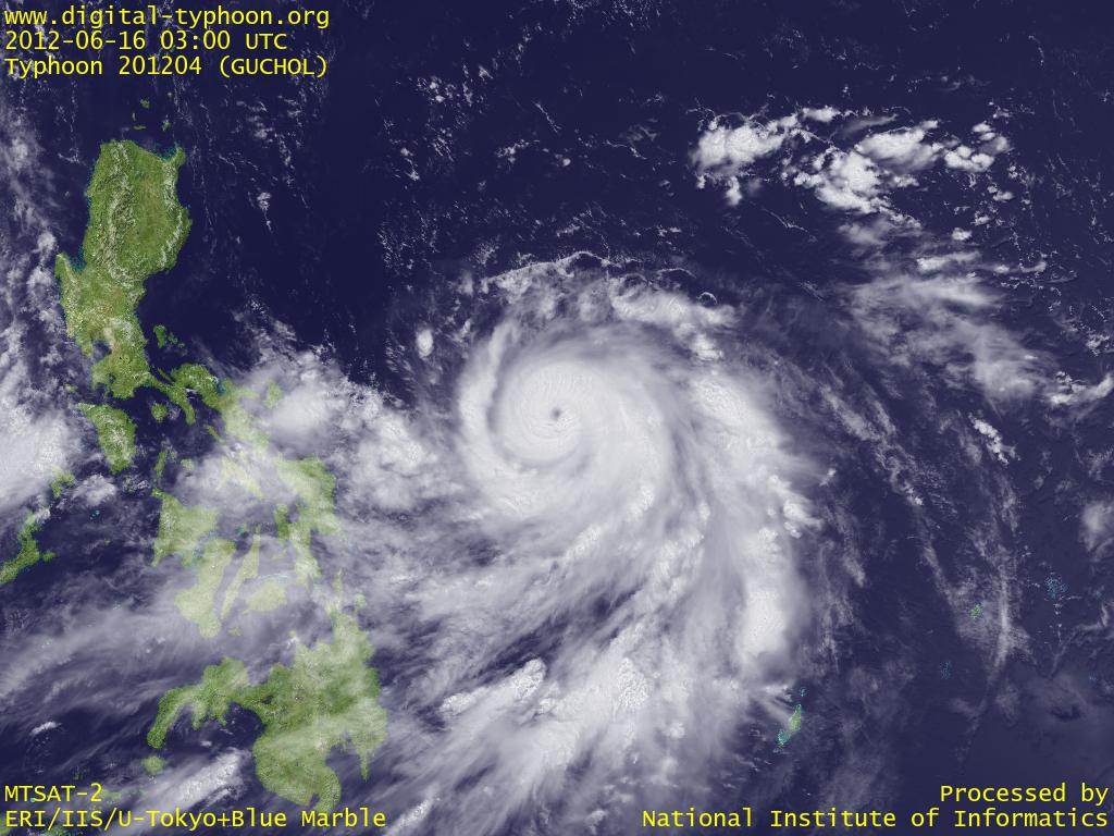
2012-06-16 14:30 JST
Typhoon GUCHOL has turned its motion toward north in east of Philippines. An eye can be seen in the center, with well-organized shape of clouds, indicating that it has now come into a developing stage. It is forecast to draw near to Ryukyu Islands while keeping intensification for the moment.
2012-06-12 16:30 JST
Typhoon GUCHOL was formed in Caroline Islands. It is forecast to move north-north-west on the Pacific for the moment, passing between Guam and Yap. For your information, the name of this typhoon is a word of Yap, where the typhoon is approaching.
Related Typhoon Blog Entries
- Typhoon 201112 (TALAS)
- Typhoon 201102 (SONGDA)
- Typhoon 200815 (JANGMI)
- Typhoon 200406 (DIANMU)
- 2005 Cyclone INGRID
- Typhoon 200918 (MELOR)
- Typhoon 200422 (MA-ON)
- Typhoon 200402 (NIDA)
- Typhoon 200415 (MEGI)
- Typhoon 200410 (NAMTHEUN)
|