|
2004-10-10
Typhoon MA-ON has made landfall on Izu Peninsula, Shizuoka Prefecture, and passed through Kanto District to the Pacific Ocean. The maximum gust of 67.6m/s was recorded at Irozaki, Izu Peninsula, the amount of rainfall increased at many places, and especially severe damage was recorded in Izu Peninsula, where the typhoon hit directly before weakening. On the other hand, the scale of damage was not extensive as warned in other areas, probably because, due to the small size of the typhoon, it could not keep its intensity after making landfall.
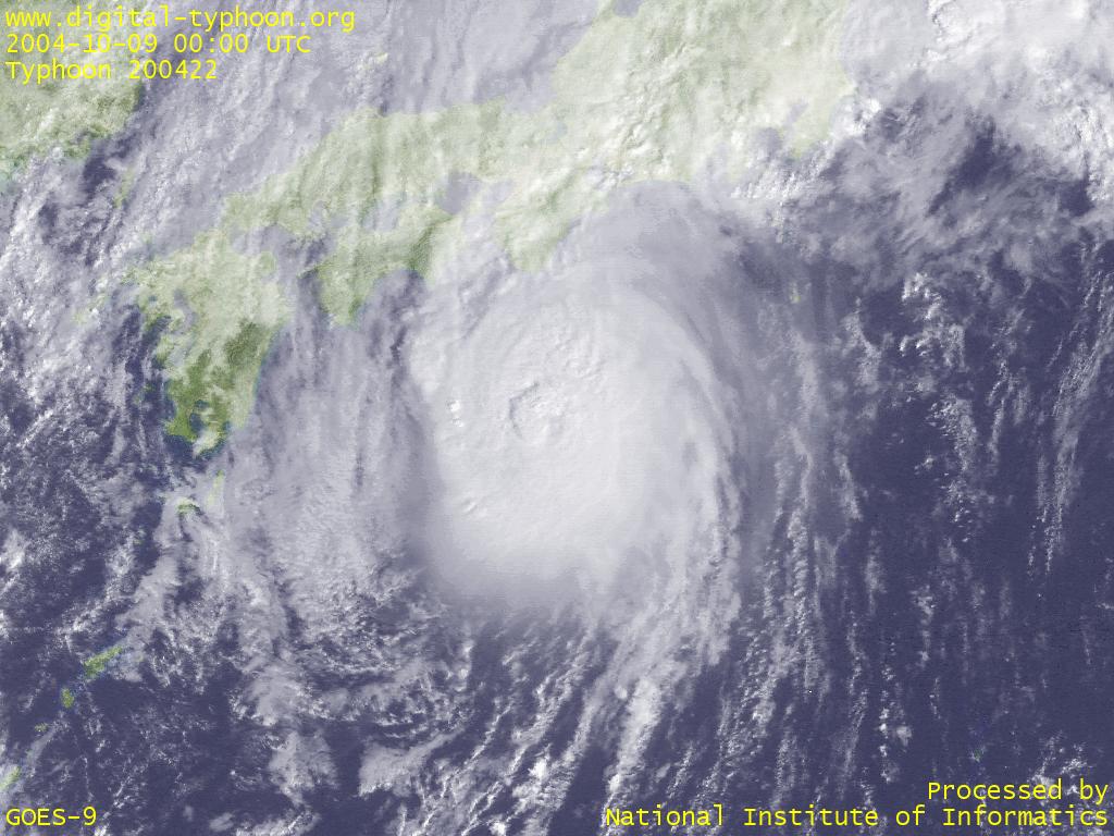
2004-10-09
Typhoon MA-ON shows the sign of weakening with its cloud shape becoming less rounded, but it still keeps strong intensity. According to Japan Meteorological Agency, the typhoon's possible landfall place is now more focused between Shizuoka and Kanto.
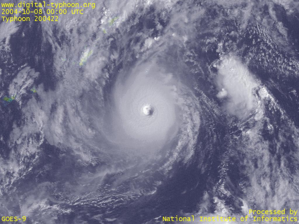
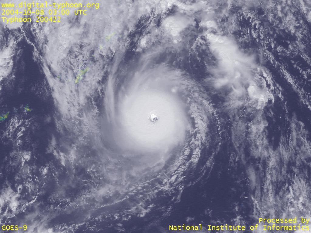
2004-10-08
Typhoon MA-ON may trace a dangerous process such that it increases its speed toward Japan after spending enough time to build up its energy over a warm ocean. By increasing its speed, it can draw near to Japan quickly without enough time for losing its intensity, and the wind speed is added by its own movement. And the effect of wind is more severe on the direct strike of a typhoon like this, which is not gigantic but very strong.
Typhoon MAEMI last year traced a similar process to this typhoon, resulted in extensive damage, so especially concerned is the situation of Daito Islands which is likely to be hit directly with its peak intensity. After that it is forecast to pass between Kinki and Kanto. Of course it is important to be on alert not only for strong winds but also for heavy rains from the band of clouds in the autumn season.
2004-10-07
Typhoon MA-ON intensified very rapidly and its eye is clearly visible now.
2004-10-05
Typhoon MA-ON's clouds are changing in a day, but it seems that the condition is still not met for the intensification of the typhoon. In the afternoon, the spiral pattern of the cloud became more apparent than before. And in the afternoon, although the size is relatively small, the spiral shape is getting more apparent. If the atmospheric condition becomes favorable for the development of the typhoon, rapid intensification is not rare around this place.
2004-10-04
Typhoon MA-ON was born in east of Philippines.
Links
Related Typhoon Blog Entries
- Typhoon 200503 (SONCA)
- Typhoon 200406 (DIANMU)
- Typhoon 201215 (BOLAVEN)
- Typhoon 200504 (NESAT)
- Typhoon 200424 (NOCK-TEN)
- Typhoon 200417 (AERE)
- Typhoon 200415 (MEGI)
- Typhoon 200918 (MELOR)
- Typhoon 201214 (TEMBIN)
- Typhoon 200715 (KROSA)
|