|
2009-08-09 21:00 JST
Typhoon MORAKOT is causing extensive disasters in Taiwan. According to Central Weather Bureau of Taiwan, the rainfall from 00 LT of August 6 to 19 LT of August 9 reached 2726mm at Alishan and 2551mm at Weiliaoshan. This is an incredible rainfall - Torrential rain observed by Japanese AMeDAS has recorded the maximum rainfall of about 1300mm in 3 days (*1), but the rainfall in Taiwan is more than double in 4 days. News of floods and landslides have been reported, and 34 people were killed or missing, but the whole picture of the situation might not be clear now.
2009-08-09 13:00 JST
Typhoon MORAKOT has passed Taiwan and is now moving northward in Taiwan Strait. In spite of making landfall at Taiwan, this typhoon keeps strong winds because of its large size. Sakishima Islands and Taiwan has been suffering strong winds for a long period of time due to the large size and slow speed of the typhoon. Yonaguni Island has been within the 50-kt strong wind area for about two days, and AMeDAS Yonagunijima shows that wind speed has been about 20m/s or more for about three days, and this strong wind has made the traffic disrupted in the middle of the tourist season. Heavy rains, on the other hand, are observed in Yaeyama area, especially at Yonagunijima with more than 300mm of rain in 3 days, but other areas of Okinawa did not have so much rain.
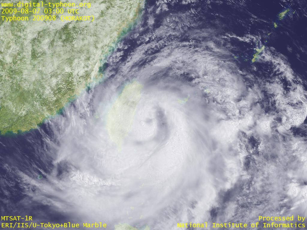
2009-08-08 11:15 JST
Typhoon MORAKOT has made a landfall at Taiwan. The typhoon is now moving northward along the east coast of Taiwan, and it is forecast to move across Taiwan Strait to mainland China. Because of the northward movement, thick clouds in the southern part of the typhoon are now approaching Okinawa, and some places of Okinawa may have heavy rains after long hours of strong winds without much rains. This typhoon killed 11 people in Philippines, and some places in Taiwan observed heavy rains of more than 1400mm.
2009-08-08 10:45 JST
Due to the maintenance of the system, the update of information has been unstable yesterday in the middle of the approach of Typhoon MORAKOT to Sakishima Islands and Taiwan. The system has almost recovered, but some unstable factors are not solved yet, so the system has not been totally recovered.
Other pages of the Web site have troubles for other reasons. Firstly Twitter Version seems to stop the update of information (we are actually trying to update the information). This is due to the trouble of Twitter on August 6, and it seems that the posting of messages has been restricted since the trouble. Secondly, realtime AMeDAS (AMeRAS) has been experiencing unstable update of information due to the sporadic delay of data distribution from the source.
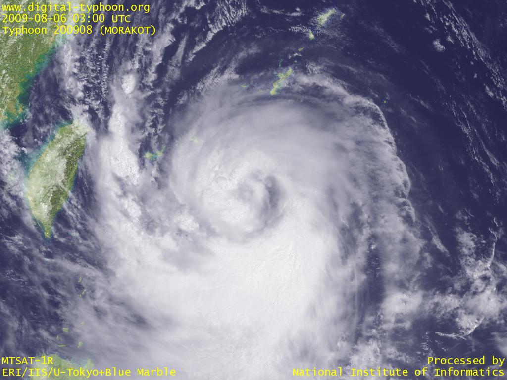
2009-08-06 21:00 JST
Typhoon MORAKOT is moving westward in south of Sakishima Islands, and those islands are now inside of the 50 kt strong wind area. Shimoji at Miyakojima observed 26m/s wind on 20:00. Okinawa main island and Taiwan are also inside of the 30 kt wind area. This typhoon is large, but its clouds near the center are still relatively thin, and thick clouds are found in the south quadrant of the typhoon. For this reason, Okinawa real-time AMeDAS shows that this area did not have so much precipitation so far. However, depending on the movement of the typhoon, these rainy clouds may cover the islands and bring heavy rains.
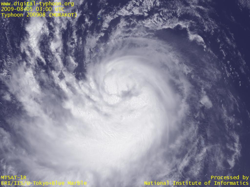
2009-08-05 20:30 JST
Typhoon MORAKOT's clouds were, in the beginning, widely scattered and less clouds found in the center, but now the clouds are gathered in the center, and the typhoon is showing the sign of intensification. The typhoon has been large from the beginning, and forecast from Japan Meteorological Agency was upwardly-revised, so Okinawa may be extensively affected by the typhoon.
2009-08-04 07:45 JST
Typhoon MORAKOT was formed in south of Japan. Forecast says that this typhoon will move west toward Okinawa region. Tropical depression information has been already issued for this typhoon, but the formation was later than Typhoon GONI.
Related Typhoon Blog Entries
- Typhoon 200813 (SINLAKU)
- Typhoon 200706 (PABUK)
- Typhoon 201106 (MA-ON)
- Typhoon 200517 (SAOLA)
- Typhoon 200909 (ETAU)
- Typhoon 200709 (FITOW)
- Typhoon 201303 (YAGI)
- Typhoon 200510 (SANVU)
- Typhoon 200514 (NABI)
- Typhoon 200916 (KETSANA)
|